Introduction
The National Weather Service (NWS) API allows developers access to weather forecasts, alerts, and observations, along with other data. The information obtained via the API is open data and free.
Read the NWS API documentation and examples. Use it in the projects.
Latitude/Longitude
To obtain the most accurate weather data for a location
you will need its latitude/longitude.
Click here
 for a web based latitude and longitude finder.
Project #1
Display the current weather for your location.
Display/format the data in a pretty/readable/useful format
if you have the time and the inclination.
(See Python GUIs
 )
)
Project #2
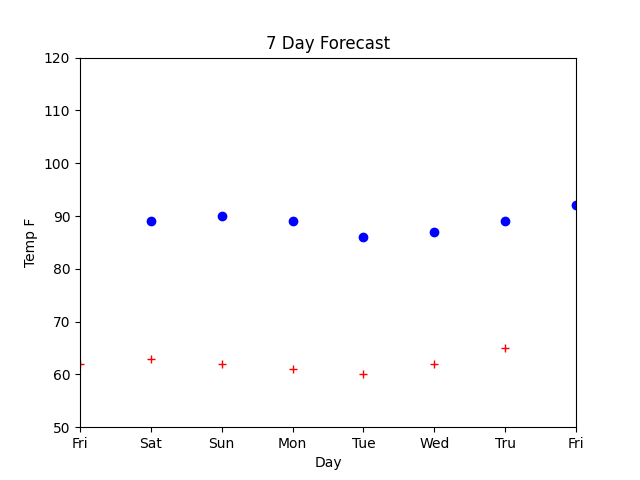
Given the following forecast data, plot the 7 day high and low temperatures.
I suggest you use the pyplot or related modules.
matplotlib.pyplot (documentation and examples)

Project #3
Using the current forecast for your location, plot the 7 day high and low temperatures. (Same as Project #2 but different/current data.)
Project #4
What climate data is available? Pick some, plot some.
National Centers for Environmental Information

Sample Code
Links
How to use the weather.gov API
National Weather Service (home)
National Weather Service Web API (documentation)
10 Best Python Weather API Libraries
Getting the Weather With Python
How to use the NOAA API to query past weather data for a given set of coordinates
JSON encoder and decoder
Python Requests Module Documentation