Project #1
Assume that x is the height the tallest mast on a sail boat. Create a table of mast heights (10, 20, 30, 40, ..., 100) and how far a boat must sail (longitude/degrees) before the top of the mast is no longer visible.
Display the angle in degrees, minutes, seconds.
Project #2
Add to the table created in Project #1 how far the boat has sailed
in feet, miles, nautical miles, meters, and/or kilometers.
Remember distance traveled is on the surface of the earth
which is curved.
Project Assumptions and Equations
- the earth is a perfect sphere
- you can see clearly (haze does not effect seeing long distances)
- 3959 earth radius in miles
- 6371 earth radius in kilometers
- 24875.11 earth circumference in miles
- 40030.14 earth circumference in kilometers
- you are located on the prime meridian;
you are on the equator looking directly west
(This does not matter with a perfect sphere, but this will help clarify thinking.)
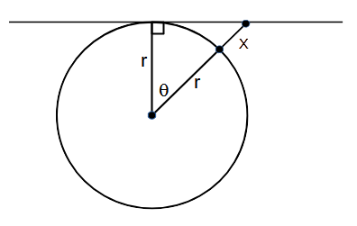
| r | radius of the earth adjacent side of right triangle and angle θ |
| x | height of mast |
| r + x | hypotenuse of right triangle |
| θ | angle (at the equator it is a measure of east/west longitude) |
Notes:import numpy as np hypotenuse = r+x = r/np.cos(θ) θ = np.arccos(r/(r+x))
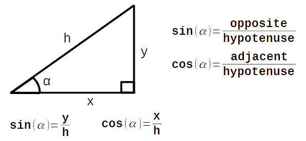
1. If (y/h) is the cosine of θ, then θ is the arc cosine of (y/h).
2. In Python the angles are measured in radians, not degrees.
45 deg = 0.7854 rad
90 deg = 1.5708 rad
135 deg = 2.3562 rad
180 deg = 3.1416 rad
What is Sine and Cosine